K2 - The Mountain with Style
And the Himalayas
By Emma, age 10, March 2008, for Briteschool Primary
This Report will tell you about
Facts
Heights
Location
Mountain Users
Impact of Visitors
Gallery
Climate
Nature of Environment
Pictures
Climbing
Index
Title Page
Index
Facts
Climate
Location
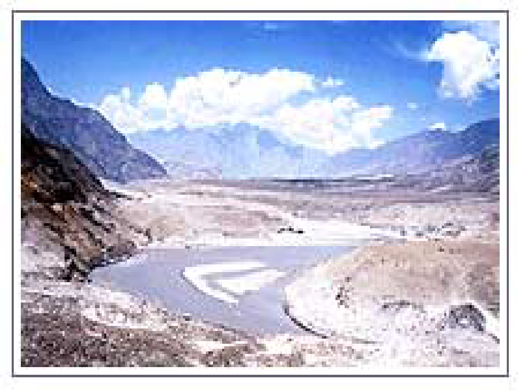
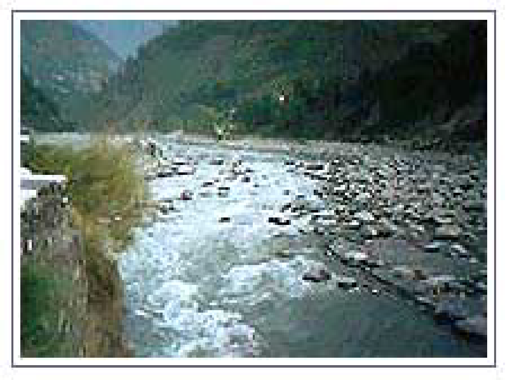
Rivers in the Himalayas
Mountain Users
Impact of Visitors
Life in a Mountain Environment
Nature of Environments
Expeditions
Originality of the Himalayas
Gallery
Conclusion
Glossary
Back Page
Words in the Glossary are in Italic
The names run in the order of the pages
I hope you enjoy reading this report!
K2 - Style Profile (Facts)
K2 is the second highest mountain in the world.
Many Climbers state that K2 is harder to climb than Mount Everest.
Most Climbers leave K2 to one of their last to climb of the Himalayan Giants.
Other Names
Include:
Mount-Godwin-Austen
Lamba
Pahar
Dapsang
Kechu
Ketu
Qogir
Chogio Ri
Those who climb K2 must acquire entry via Pakistan as the Chinese side is inaccessible.
K2 is a rocky mountain up to
6,000m, beyond which it becomes an ocean of snow. The traditional
route to K2's base camp goes from Skardu, which is linked with
Islamabad by a good road. From Skardu the route goes via
Shigar-Dassu-Askole up to Concordia over the Baltoro glacier.
K2
was firstly discovered and measured by the Survey of India in 1856,
and first named for English topographer Henry Godwin - Austen, who
explored and surveyed the region.
K2 is taken from the first
letter of Karakorum, and the number indicates that it was the second
peak in the range to be measured. K2 was firstly climbed on July, 31
1954 by Italian climbers team lead by Ardito Desio and accompanying
him were Lino Lacedelli and Achille Compagnoni. A March 1987
measurement of K2 indicated that it might be higher than Everest, but
later that year, Everest was re-measured by a similar method and
found to indeed be 778 ft (237m) taller.
In some mountainous areas the rivers are permanently frozen. These are called glaciers.
Heights of mountains are generally given as heights above sea level.
It is like a giant pyramid formed of ice with a maze of precipices. It is almost a regular cone of ice resting on a granite base.
Climate
Weather
The rainfall, mainly from the monsoons, decreases from the east to the west. Comparatively, in winter, due to the influence of tropical west wind drift, the northwest areas have more precipitation in the form of rain and snow. From these snow covered ranges with big glaciers, flow the great rivers that have made the Indo-Gangetic plain one of the most fertile in the world and the heart Land of India.
Climatic
Variation In
The Himalayas the climate varies according to the elevation. It gets
colder as the elevation increases and gets wetter as the elevation
drops. As a result the temperature and climatic changes in the
Himalayan regions change very quickly. All of a sudden there can be
occurrences of monsoons, floods, high winds, snowstorms and other
types of precipitation, which makes the climate over here quite an
unpredictable and dangerous one.
The two major seasons of the
Himalayan region are winter and summer. During the winter the region
receives the maximum snow with very icy temperatures. Summers are
quite mild over here, making it a good summer holiday hideouts.
Usually throughout the year the Alpine Himalayan region receives
Snow.
Beyond The Monsoon
The
regions such as Ladakhis & Zanskar that lie to the North of the
main Himalayan range and escape the full impact of the monsoon.
Humidity is always low in these regions, and receives only a few
centimetres of rainfall a year. These regions also experience some of
the coldest temperatures anywhere in the world, and it doesn’t
get any warmer until the spring season in late April or early May.
In June, daytime temperatures frequently rise to the mid 200Cs,
the snow on the passes melts and most of the treks can be undertaken
from then on until the middle of October. Heavy rainstorms can
occasionally be experienced in July and August, and River crossing
should be undertaken with great care at this time. By September the
conditions are ideal, and they normally remain so until late October
even though night-time temperatures may fall below freezing. By
November, the early winter snow falls on the passes closest to the
Himalayas. In winter the villagers still travel, enduring the intense
cold, to follow the valley floors where River crossings are no longer
a problem.
After October the daytime temperatures drop, but the
weather is generally settled until the middle of November when the
first of the heavy winter snows fall on the high mountain passes.
Winter months from December to March are often bleak. April and May
are characterised by heavy precipitation, which falls as snow in the
mountains, precluding trekking over the passes until the spring snows
melt in June.
Most of the hill states of the West Himalayas
including Kangra and Chamba, the Kullu valley, Shimla in Himachal and
most regions of the Garhwal and Kumaon in Uttaranchal come under the
influence of the Indian monsoon. Both Darjeeling and Sikkim are
subject to the Indian monsoon that sweeps up from the Bay of Bengal,
bringing heavy rainfall from early June until the end of September.
The post-monsoon months of October and November provide settled
conditions, with clear views of the mountains, although night-time
temperatures above 3,500m frequently fall below freezing.
Location
Longitude:
76°
30' 24"
Latitude:
35°
52' 33"
Location:
China/Pakistan
Karakoram Border
Himalayan Range
Karakorum also has several of the world's largest glaciers.
The High And Mighty
The Himalaya is the world's mightiest mountain range. No other chain can boast of peaks of 8,000 metres (26,000 feet). In the Himalaya there are 14 such peaks and hundreds of summits over 7,000 metres (23,000 feet) high. The range of mountains stretches 2,700-kms (1,700 miles) across an area between Assam and Kashmir. In the east, Namche Barwa stands sentinel; the western extremity is guarded by the awesome Nanga Parbat.
Rivers in the Himalayas
|
Major Himalayan Rivers: |
Indus, Sutlej, Ganga, Yamuna, Brahmaputra |
Rippling along rough surfaces and the beautiful meadows, the numerous rivers that dot Indian mainland are central to our history as well as to Indian mythology. The main rivers of the Himalayas group are the Indus, the legendary Ganga and the Brahmaputra. These rivers are both snow-fed and rain-fed and therefore perennially flow throughout the year. Himalayan rivers discharge about 70% of their inflow into the sea. This includes about 5% from central Indian rivers. They join the Ganga and drain into the Bay of Bengal.
The Five Sisters
The very names of these rivers roll like music-Jhelum, Chenab, Ravi, Beas and Sutlej. Their ancient names were more musical still: "Vitasta", "Askini", "Irawati", "Vipasha" and "Shatadru" ....
Indus River
The Trans Himalayan Indus River rises near the Mansarovar Lake on the Tibetan plateau. It enters the Himalayas in south-eastern Ladakhis near its confluence with the River Gurtang at an elevation of 4,200m. Thereafter it follows a north by northwest course between the towering Ladakh range in the north and the Zanskar Range in the south. There are a number of human settlements that lie along the Indus River in Ladakh, namely Leh, Marol, Skardu and
Bunji.
....
Sutlej
River
River Sutlej takes birth on the southern slopes of the holiest of mountains - Kailash, near the holiest of lakes Mansarovar. After a long run, parallel to the Himalayas, it finally penetrates these at Shipki pass. Later it cuts through the Zanskar range, makes a diagonal thrust through the Himalayas and blasts a deep gorge at the base of the Kinner Kailash massif. Within Kinnaur district, the Sutlej runs parallel to the Hindustan-Tibet Road. At Karcham, in Kinnaur, it is joined by the crystal clear, blue river Baspa that drains the Sangla valley .....
Cheanab River or River Chandra Bhaga
Chandra River is one of the two rivers; the other one is Bhaga, which merges to form the Chenab in the Lahaul region of Himachal Pradesh. It rises in the snows lying at the base of the main Himalayan range in the Lahaul and Spiti district. The picturesque lake of Chandra Tal forms at this rivers source site .....
Beas River
The Beas forms the valleys of Kullu and Kangra, famed for their beauty. But ironically, its source is an insignificant looking igloo like structure near Rohtang Pass in Pir Panjal range to the north of Kullu. The main thrust of this river is southward to Larji and then to the west. Where it enters Mandi district and further still into Kangra......
Ravi River
There is something intrinsically romantic about the river Ravi. In divided Punjab used to ring with the haunting strains of love songs sung on the banks of the Ravi, which flowed past the elite city of Lahore. Now one only has to hear the outpourings of young hearts in Chamba celebrating the beauty of love and nature to know that the spirit of the Ravi is the same everywhere. Chamba town rests on a mountain shelf on the right bank of the river. As a settlement it is Indian to the core. Here, as in many ancient towns, flourished a civilisation that provided patronage to the arts so that the temple sculptures of Chamba are truly amazing.......
Jhelum River
The Jhelum flows from the spring known as Verinag, 80-km south of Srinagar. This wide, swift flowing, muddy but picturesque river sweeps through Srinagar and is famed for its nine old bridges among many things else ......
Spiti River
The valley of Spiti derives its name from the Spiti River, which rises just below the 16,000 ft high Kunzum Pass. After flowing for about 60 miles, it joins the Sutlej River near the village of Namgiya in Kinnaur district ......
Ganga or Ganges River
The holiest of all the rivers, Ganga or the Ganges is a perennial river, which is held in high regard by the Hindus. The Ganga river has an exalted position in the Hindu ethos. The Gangotri Glacier, a vast expanse of ice five miles by fifteen, at the foothills of the Himalayas (14,000 ft) in north Uttar Pradesh is the source of Bhagirathi, which joins with Alaknanda, to form Ganga at the craggy, canyon-carved town of Devprayag.
Yamuna River
Yamuna, also called as “Jamuna”, originates from the Bundar Poonch glaciers in district Uttarkashi of the state of Uttaranchal. It rises from Jamunotri, in the Himalayas. River Tons, which flows along the boundary of Himachal Pradesh, west of district Tehri Garhwal joins Yamuna River at Kalsi and thereafter joins the plains. From Kalsi, the river flows along the boundary of Himachal Pradesh. Yamuna flows in a southerly direction through the Himalayan foothills and onto the northern Indian plain, along the Uttar Pradesh-Haryana State border. The Eastern and Western Yamuna canals are fed from the river at that point.
Brahmaputra River
One of the great rivers of Asia, the Brahmaputra commences its 3,000-km journey to the Bay of Bengal from the slopes of Kailash in western Tibet. As Tibet's great river, the Tsangpo, transverses east across the high-altitude Tibetan plateau north of the Great Himalayan Range, carving out myriad channels and sandbanks on its way. As it tumbles from the Himalayan heights towards the plains of the subcontinent it twists back on itself, cutting a deep and still unnavigated gorge, until finally turning south it emerges in Arunachal Pradesh as the Dihong. Just beyond Pasighat, it meets the Dibang and Lohit where it finally becomes the Brahmaputra.
Mountain Users
People And Tribes
Ethnic Himalayan People:
Negroids
Mongoloids
Aryans
The
Hindu epics and Puranas refer to the original inhabitants of the
Himalayas- the Kulinds, Kiratas and Kilinds, Kiratas and Kinnars and
later texts mention the Khasas and the Darads. Today three ethnic
types constitute the Himalayan population: Negroids, Mongoloids and
Aryans.
From very early times there have been migrations into the
Himalayas and within it. Spiritual quest motivated a few to migrate
there, and a small minority responded to the call of these mountains
to test their own endurance and will power. Pursuit of profit
propelled others.
Bhutiyas
Of Bhutan of Mongolian origin
People Of Sikkim
Nepali People
The people of Nepal are a complex mix of racial patterns. These are
part of the mongoloid, tribally organized groups of hill farmers who
dominate the middle hills. The Sherpas of the Solo Khumbu region in
the northeast of the country are among the many Bhutiya groups who
speak dialects of Tibetan.
People Of Himachal Pradesh In Kumaon
and Garhwal, in the central Himalayas, Khasas and Doms were the
original inhabitants.
People Of UttaranchalIn Himachal Pradesh,
the descendants of these Khasas are known as “Kanets”
The
LadakhisThe Ladakhis are of ethnic stock different from that of the
people of Kumaon and Garhwal. According to folklore, Ladakh was once
totally populated by Darads. The latest archaeological finds give
credence to this popular belief. The Mons belonging to the Mongoloid
stock, and who are now far more numerous there, seem to have migrated
at a much later date.
Most people in the Himalayas sustain
themselves by a combination of agriculture and animal husbandry.
Until very recently, those inhabiting the higher reaches migrated to
lower altitudes during the winter months. Trade played an important
role in the lives of the frontier villages in Ladakh, Himachal,
Kumaon and Garhwal. Before the advent of the British, the contacts of
Sikkim and Bhutan with Tibet were closer and more frequent.
Impact of Visitors
The Himalayas provide considerable evidence for developing knowledge and understanding of environmental change and sustainable development. The increasing number of visitors to the Himalayas has both benefits and costs for the area and its people. Perhaps the greatest impact has been on Everest and its surrounding area. Despite the remote setting, Everest is the greatest goal for many mountaineers, and their activities impact on both the environment and the lives of the people of the Himalayas.
The use of oxygen canisters by mountaineers means that large numbers of empty canisters have been dumped at base camps around the Himalayas. A scheme has been set up to try to resolve this problem.
Life in a Mountain Environment
Mountains don’t just exist as a challenge for visiting climbers. For the Sherpas of Tibet and Nepal and other indigenous people, climbing is a necessity, and the steep slopes and mountain weather shape their way of living.
Nature of Environments
Forest Cover - The Glory of the Himalayas
Most of the Himalayan regions have a harsh environment therefore few animals and plants can survive over here. The few plants that do inhabit the Alpine consist of rhododendrons, the tea plant and shrub type plants. They have to adapt to the freezing temperatures, high winds and to a short growing season. That is why most of the plants grow low to the ground.
All mountain ecosystems have one major characteristic in common - rapid changes in altitude, climate, soil, and vegetation over very short distances.
Plants that may be found on mountains include conifers, oak, chestnut, maple, junipers, stonecrops, campions, mosses, ferns and climbers.
Expeditions
In 1954, an Italian expedition came to Pakistan to try its luck on K2. It consisted of twelve climbers and four scientists and was led by veteran mountaineer, Professor Ardito Desio, who had come to these mountains with Italian expeditions before the World War II.
Another American attempt on K2 was made in 1953. The expedition leader was Dr. Charles Houston, who had also led the 1938 American expedition on this peak.
The next year saw another American expedition on K2. It was led by Fritz Hermann Ernst Wiessner, a German-American chemist and mountaineer. The expedition, along with nine Sherpas, made very good progress on the already-identified south-east ridge.
Two famous British mountaineers, Harold William Tilman and Eric Earle Shipton, explored and surveyed the north face of K2 and its subsidiary glaciers in 1937. In 1938, the American Alpine Club sponsored a reconnaissance party for a visit to K2 area. The party reached a height of 7925 meters after setting up eight camps.
It was probably for the first time in 1902 that an organized expedition of Oscar J.L. Eckenstein traveled to K-2 from Baltoro glacier. The expedition was without any guide. Its aim was to explore approaches to the mountain and possibly have a try on the peak. It was, however, harsh weather which prevented it from attempting the peak. In 1909, a big Italian expedition under the leadership of resolute Luigi Amadeo Giuseppe (Duke of Abruzzi) the grandson of King Victor Emmanuel II of Italy reconnoitred K2.
Originality of the Himalayas
The Himalayas is different to other mountain environments because:
It stretches across six nations including Bhutan, the Tibet province of China, India, Nepal, Pakistan and Afghanistan.
They are the source of three of the world's major river systems, the Indus, the Ganga-Brahmaputra, and the Yangtze.
Approximately 1.3 billion people live in the drainage basin of the Himalayan Rivers.
Together, the Himalayan mountain system is the planet's highest and home to the world's highest peaks: the Eight-thousanders, including Mount Everest and K2.
Himalayan system has over 100 mountains exceeding 7,200 meters.
The Himalayas are among the youngest mountain ranges on the planet.
Conclusion
I hope you have found this report useful.
K2 and the Himalayas are a challenging range of mountains for both local inhabitants, tourists and visitors.
As
the weather in the area can change very rapidly, it can be a great
cause of concern for all the mountain users.
Also, the Himalayas
are an extremely important water source for the local surroundings.
Glossary
Chogio Ri = Great Mountain
Glaciers =A large body of continuously accumulating ice and
and compacted snow
Lamba Pahar = Tall Mountain
Thank You for Reading